A traffic jam at Vinegar Hollow’s End
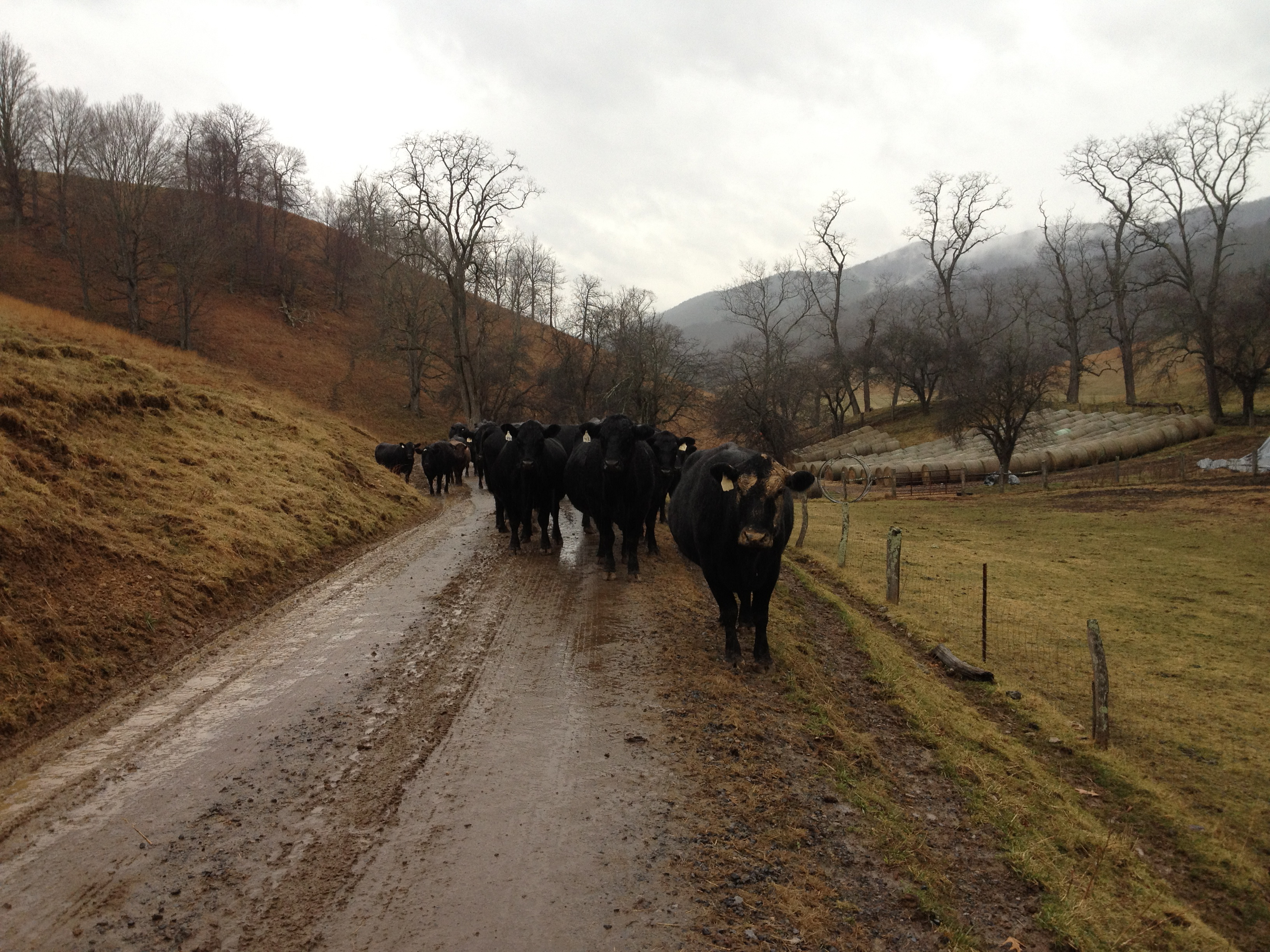
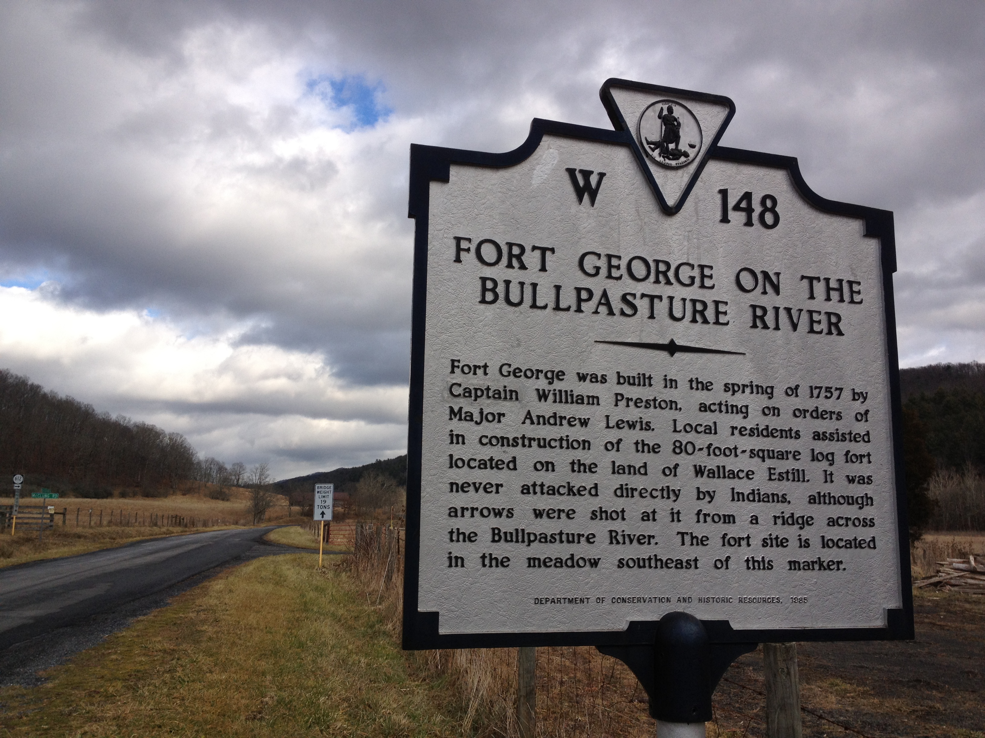
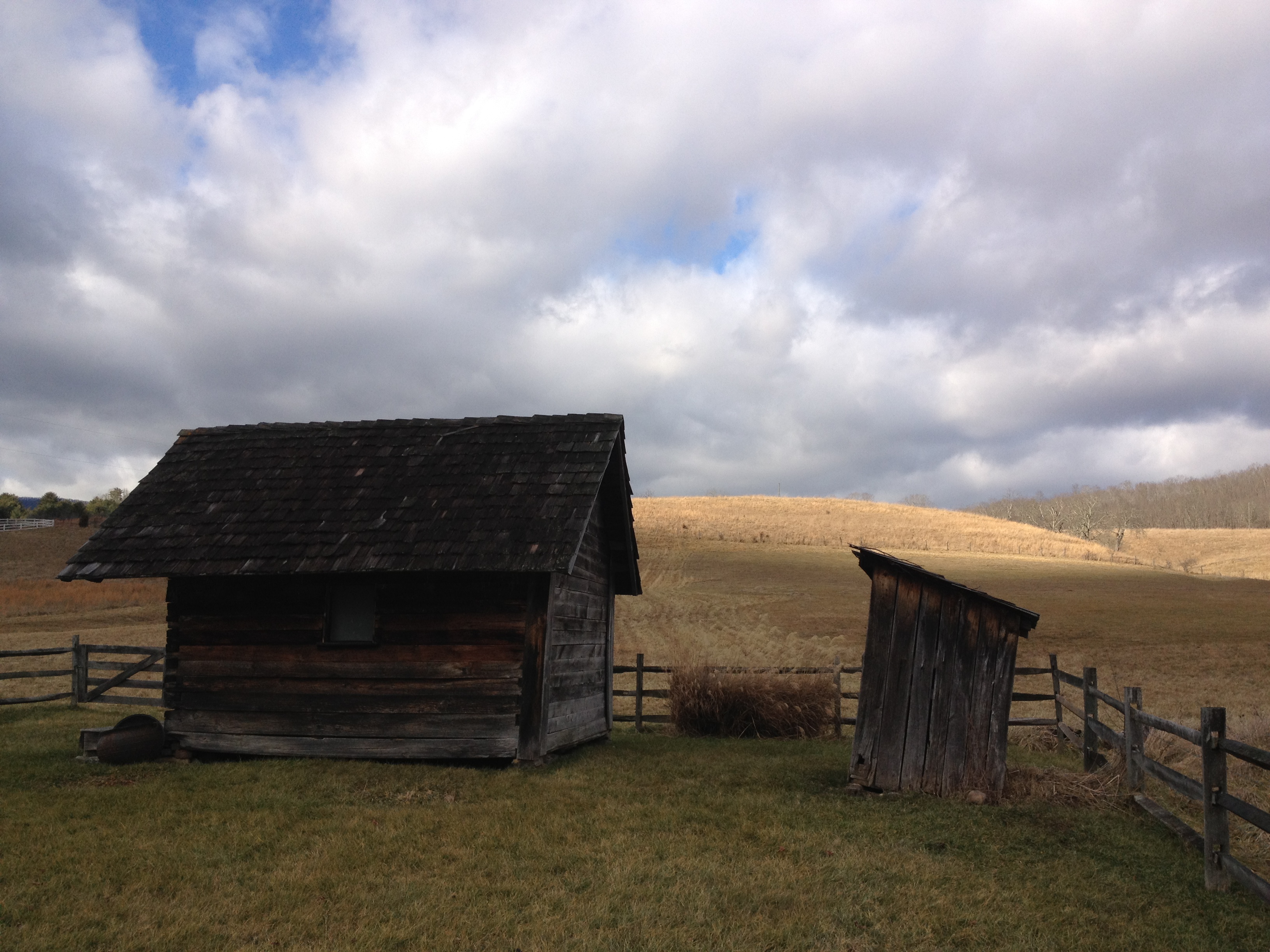
On New Year’s Day, 2012 I begin the year in Mustoe, Highland County, Virginia, tucked back in Vinegar Hollow, invisible from Mustoe proper, invisible from any other habitation for that matter. The day opens glowery, but not too cold, and glints of sunlight cause the landscape to sparkle in places. It will be a good day for a drive once we get past the cattle ambling up to the barn for their morning drink from the water trough near the house. When the cows are ambling, and they rarely do more than amble, it is best to slow down and amble as well. I wanted to show my husband the road, which I had discovered in the summer, that follows the loops of a lovely river named Wallawatoola by American Indians, but renamed Bullpasture, Cowpasture, and Calfpasture by early settlers. The Bullpasture is big, Cowpasture less big, and the Calfpasture so modest that I always miss it. In McDowell, one takes Bullpasture River Road to Williamsville, following as it curves back on itself to become Cowpasture River Road, and then hopefully one makes the jog to Calfpasture River Road, the last loop of the river. Along the way I am charmed by an historical marker that notes the site of an early fort in a nearby field. The brave little fort was “never attacked directly by Indians” but faced the onslaught of arrows from a ridge across the Bullpasture River! I try to imagine the arrows flying, some falling into the river no doubt, almost 300 years ago. Each flight of arrow is a part of history never to be repeated, except by someone like me romancing over the message from the past found on the marker. Missing the jog to Calfpasture River Road, we take the road to Sugar Grove, in love with our journey among straw-colored stubbley fields and deep purple folds of mountain ridges in the distance. Here and there straw turns to gold as the sun pierces the cloudcover. Habitations, for humans and their livestock, in various stages of repair, catch at the heart.
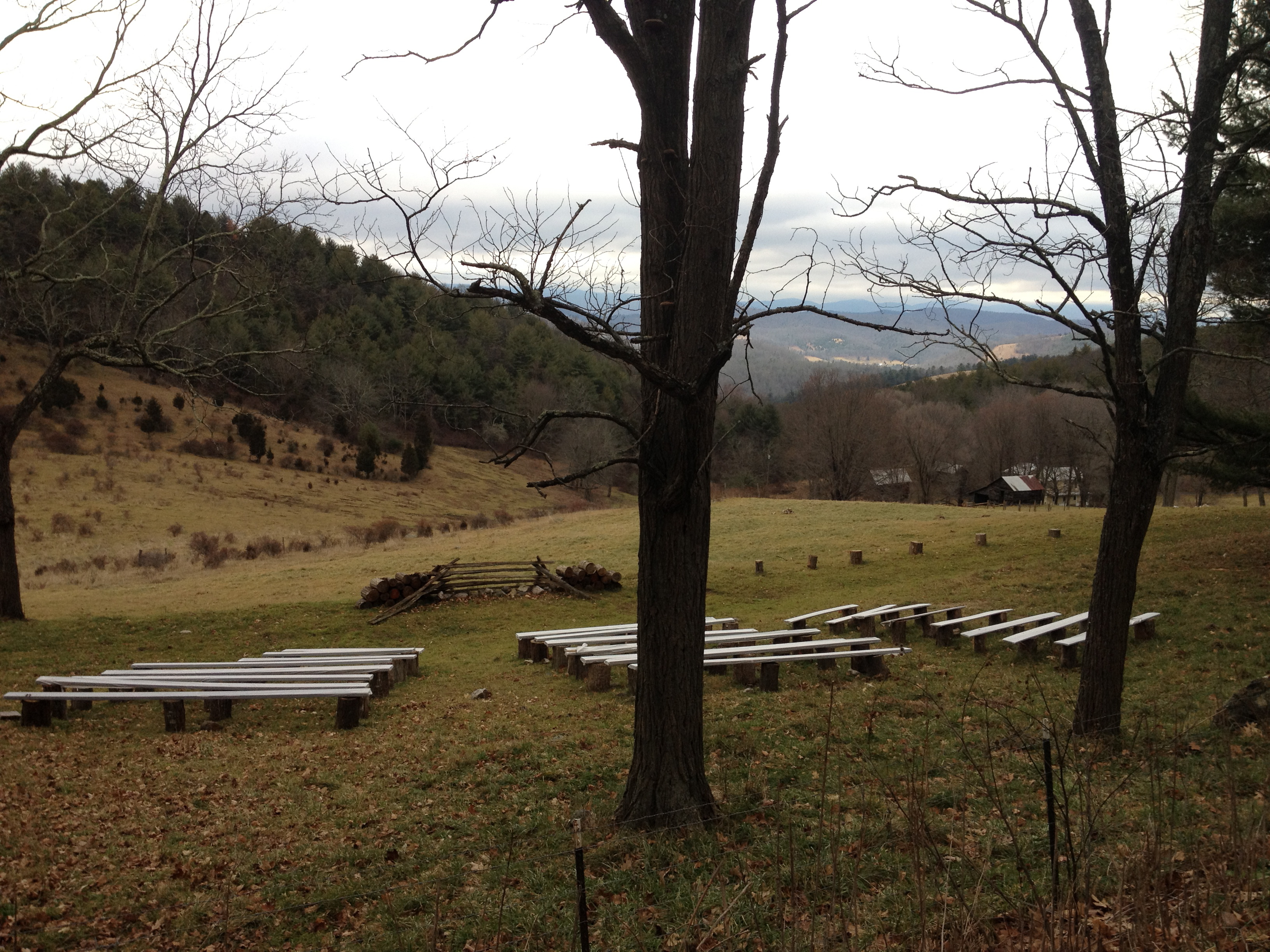
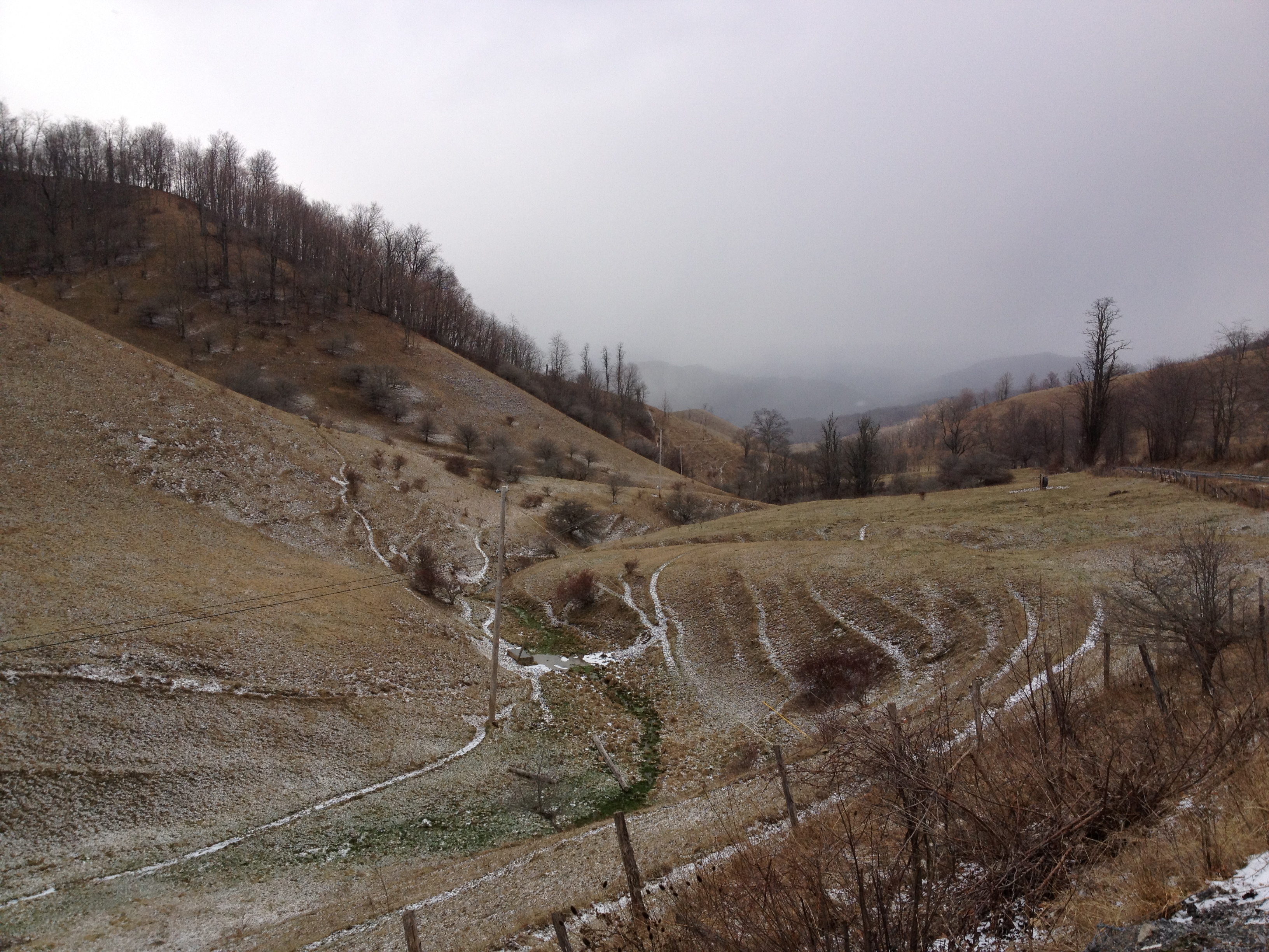
- Somewhere along the road to Sugar Grove we take Crummetts Run Road to head back towards Monterey and Mustoe. Crummetts Run Road presents extraordinary views, especially near an outdoor rustic amphitheatre situated in a field at the edge of a mountain, a place for people to be moved towards spiritual thoughts, as it seems that this must be the intent of its placement here on a high mountain fold with a view to the west. The empty seats are haunting. What souls have sat there in the past and who will sit there in the future? In that instant, pulled into the distance, I allow myself to feel there for an eternity. We do not need to take such a narrow view of where we are.

The next day it is time to leave Mustoe and head north to Ithaca. At the border of Highland County, Virginia and Pendleton County, West Virginia, we take Snowy Mountain Road. Snowflakes swirl out of a snowcloud, turning the deep purple of far mountain ridges to lavender. In the valley bottom there is still the bright green of algae and stream-loving vegetation growing yet in winter’s cold. Going over Snowy Mountain comforts my sense of departure, as its windings and views carry us from one kingdom to another, a trip we make more often than we realize–from moment to moment, day to day, year to year and so on into the unmeasurable.

It was a Happy New Year for you in your lovely Virginia countryside. Thanks for taking the reader along.